Scientists are virtually certain that California will be rocked by a strong earthquake in the next 30 years. Now they say the risk of a mega-quake is more likely than previously thought.
The chance of a magnitude-8 quake striking the state in the next three decades jumped to 7 percent from 4.7 percent, according to an earthquake forecast released Tuesday by the U.S. Geological Survey.
The increase was mainly because scientists took into account the possibility that several faults can shake at once, releasing seismic energy that results in greater destruction.
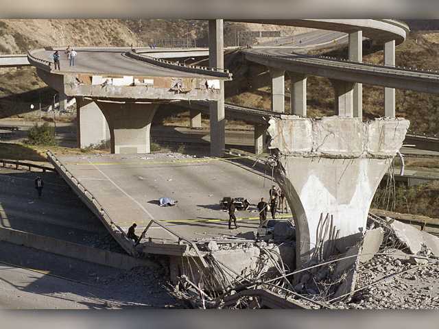
While the risk of a mega-quake is higher than past estimates, it’s more likely — greater than 99 percent chance — that California will be rattled by a magnitude-6.7 jolt similar in size to the 1994 Northridge disaster,according to the Third Uniform California Earthquake Rupture Forecast.
The chance of a Northridge-size quake was slightly higher in Northern California than in Southern California — 95 percent versus 93 percent, according to the report.
“California is earthquake country, and residents should live every day like it could be the day of a big one,” USGS geophysicist and lead author Ned Field said.
The granddaddy of earthquake faults in California is the San Andreas, which runs 746 miles from the Gulf of California north to the Cape of Mendocino and straddles two separate tectonic plates.
“For the part of the San Andreas fault near Santa Clarita, our model predicts a 17.47 percent chance it will rupture in an earthquake with a magnitude greater than 6.7 in the next 30 years,” Caltech geophysicist Morgan Page told The Signal on Tuesday.
The San Andreas Fault rift zone is north of the Santa Clarita Valley and extends through the communities of Frazier Park, Palmdale, Wrightwood and San Bernardino.
Of the more than 300 faults that crisscross the state, the southern segment of the San Andreas Fault — which runs from Central California to the Salton Sea near the U.S.-Mexico border — remains the greatest threat because it hasn’t ruptured in more than three centuries, scientists say.
The USGS report found there is a 19 percent chance in the next 30 years that a Northridge-size quake will unzip the southern section, compared to a 6.4 percent chance for the northern section.
The lower chance in Northern California is partly because it last broke in 1906 during the Great San Francisco Earthquake.
The southern San Andreas is “ready to have an earthquake because it’s really locked and loaded,” the USGS’s Ned Field said.
The report is a forecast, but it is not a prediction. Experts still cannot predict exactly where or when a quake will hit anywhere in the world.
SCV fault forecast
Asked about the expectancy of the Santa Clarita Valley’s smaller faults experiencing a rupture in the next 30 years, Caltech geophysicist Page said the likelihood is slim.
“For the San Gabriel Fault, there is a under 1 percent chance of rupturing in the next 30 years,” she said.
The San Gabriel Fault is the largest of the Santa Clarita Valley faults, extending from west of Gorman to San Bernardino County; it runs almost parallel to the San Andreas. It slices through Santa Clarita roughly from Castaic through Saugus and Canyon Country.
But Page said there are historical examples of smaller “thrust faults” like the San Gabriel triggering a major fault such as the San Andreas.
Over the next 30 years, Santa Clarita Valley faults have an extremely low chance of triggering a quake greater than 6.7, she said.
The Holser Fault — which runs about 13 miles along the north side of Highway 126, straddling the Ventura-Los Angeles county line near Piru — has a 0.3 percent chance of producing a quake greater than 6.7 in the next 30 years, Page said.
It intersects with the San Gabriel Fault east of Saugus.
The Santa Susana Fault just south of the intersection of Interstate 5 and Highway 14 extends 24 miles from Simi Valley to San Fernando Valley and has a 2.44 percent chance of producing a quake greater than 6.7 in the next 30 years, Page said.
The latest seismic calculations largely mirror previous findings issued by the USGS in 2008. Back then, scientists also determined that California faced an almost certain risk of experiencing a Northridge-size quake.
In recent years, the USGS and several universities have been testing an early warning system designed to detect the first waves of a jolt and send out an alert before the slower-moving damaging waves. Proponents have said a few seconds of notice can allow trains to slow down, utilities to shut off gas lines and people to duck for cover. The public alert system — still in pilot phrase — needs more funding before it can be rolled out statewide.